Map style

I want to share with you a new map style. I think it's best than the "default" karoo style.
-

Just installed it on my K2. Will test on next rides, but at first glance it looks really good.
My only issue was with the farmyard symbol: obviously some areas in my home region are flagged as farmyards, and with that symbol (file s_farmyard.svg in the ele-res folder) the map was confusing in places or even looking corrupted, depending on the scale. So I copied one of the wood files over the s_farmyard.svg file, this fixed the issue for me. A nice svg file for farmyards would be the perfect solution. -

Thanks for your work! Is there a guide somewhere on how to modify such a style. I really dig the original openandromaps stlyle (or even better the elevate4mtb style https://gitlab.com/winni/elevate/-/blob/master/Elevate4MTB.xml?ref_type=heads ) and would like to have something like that.
-

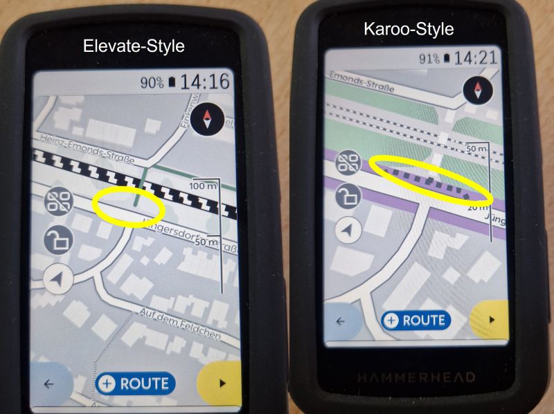
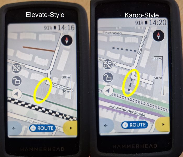
In total it looks great, but I am facing 2 issues with the rendering.
Some ways/paths are missing and there are some overall rendering issues.
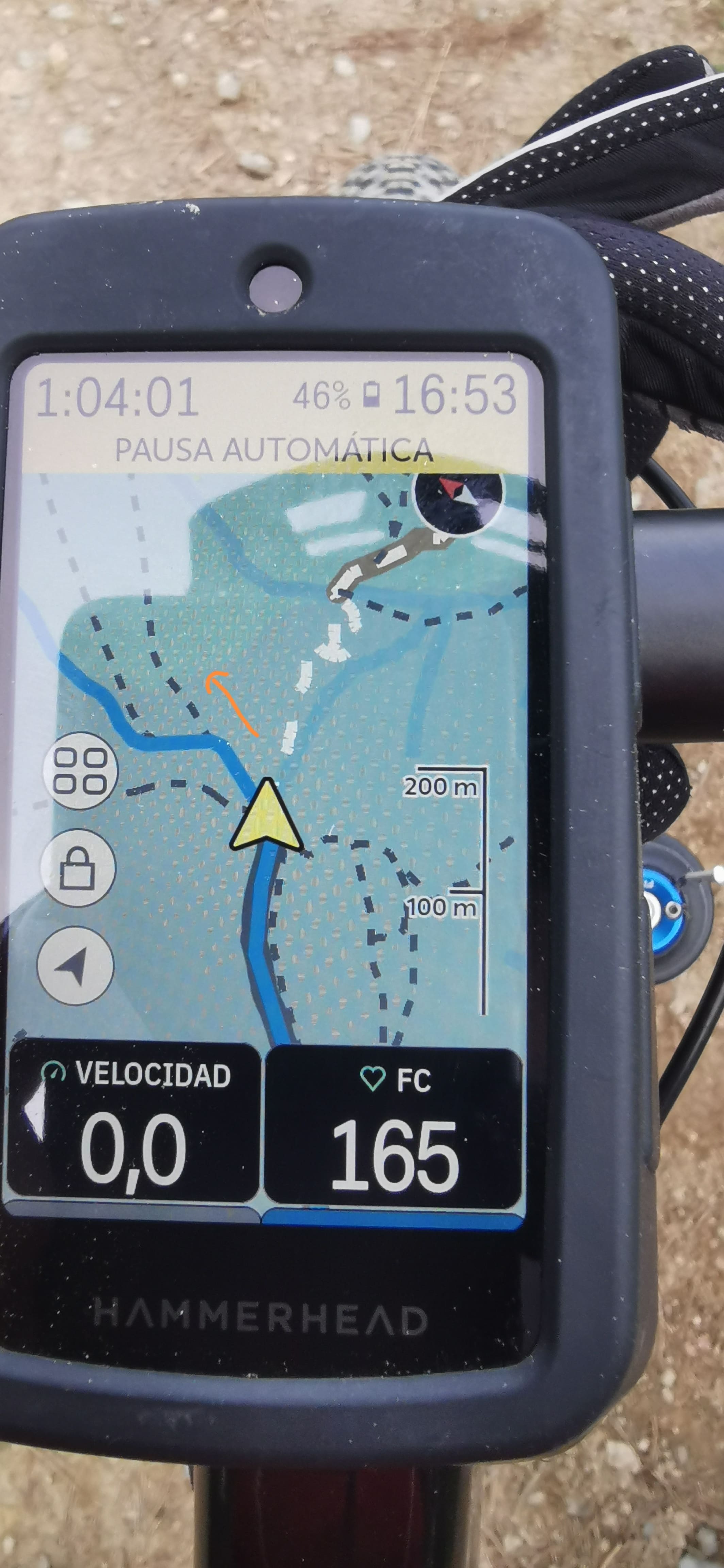
Have a look at some sample screenshots and the information about the current version of the Elevate style download. My Karoo is running latest Build Version: 1.541.2070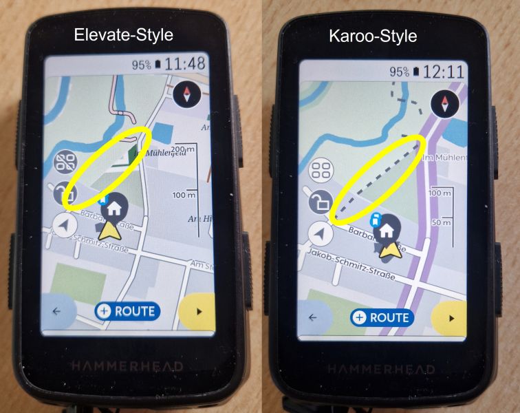
What is going wrong?
-

Hello,
Came across this thread and really cool to see. Would love to hear feedback on what people do not like about our current map themes and how we can improve them in the future.
One note on the missing paths in the thread above. Each of the missing paths in our map theme is a footpath. We do not route on those paths for navigation, but we do show them in case someone needs to walk their bike as an example. If you are excluding footpaths only in your map theme, that could be a lead for why they are not appearing.
-
Hello! i'm the one that made this version of the map. This style is based in elevate but it's based also in karoo original style. Elevate map style is very "dense" for a gps, then I took elevate maps, some elevate ideas and karoo original style (it's a good style) and i've adapted (Karoo is a good style but I think it's a little "strange" if your use is mainly MTB).
Product team answer your question, this map style doesn't show "exclusive/primary" footpath (house paths neither) ... I can added (it's easy) but i've to think about it because this introduces "noise".. My idea is we have a map where you can see easily the correct path (this is so important for a GPS, but it's a must .. if you use MTB and you are over the 40 and you can't see fine ;)
-
Hi John. I'm using the "offline_v9.xml" provided by Enderthor from "https://github.com/lockevod/Karoo-GPS-Style".
-
@productteam It's not the “do not like your current map themes”. They are good, easy to read and reduced to the essentials, but from my point of view more suitable for road bike rides.
Like Enderthor, my main use is on MTB and Gravel routes. On these routes, I often use paths and footpaths. And since I have been using “openandromaps” maps for ages and am very familiar with the Elevate themes, the customization of Enderthor works better for me.A profile-related option to select various map themes (Trail/MTB; Gravel/Trekking Road/City) would be interesting. Another interesting alternative would be to install free maps (e.g. “openandromaps”) and activate them profile-related.
-

Hola, porque el mapa Karoo no distingue entre pista forestal ancha y senderos estrechos, los marca igual con rayitas --------------- no deberían ser diferentes?
Hello, because the Karoo map does not distinguish between wide forest trails and narrow trails, it marks them the same with lines --------------- shouldn't they be different?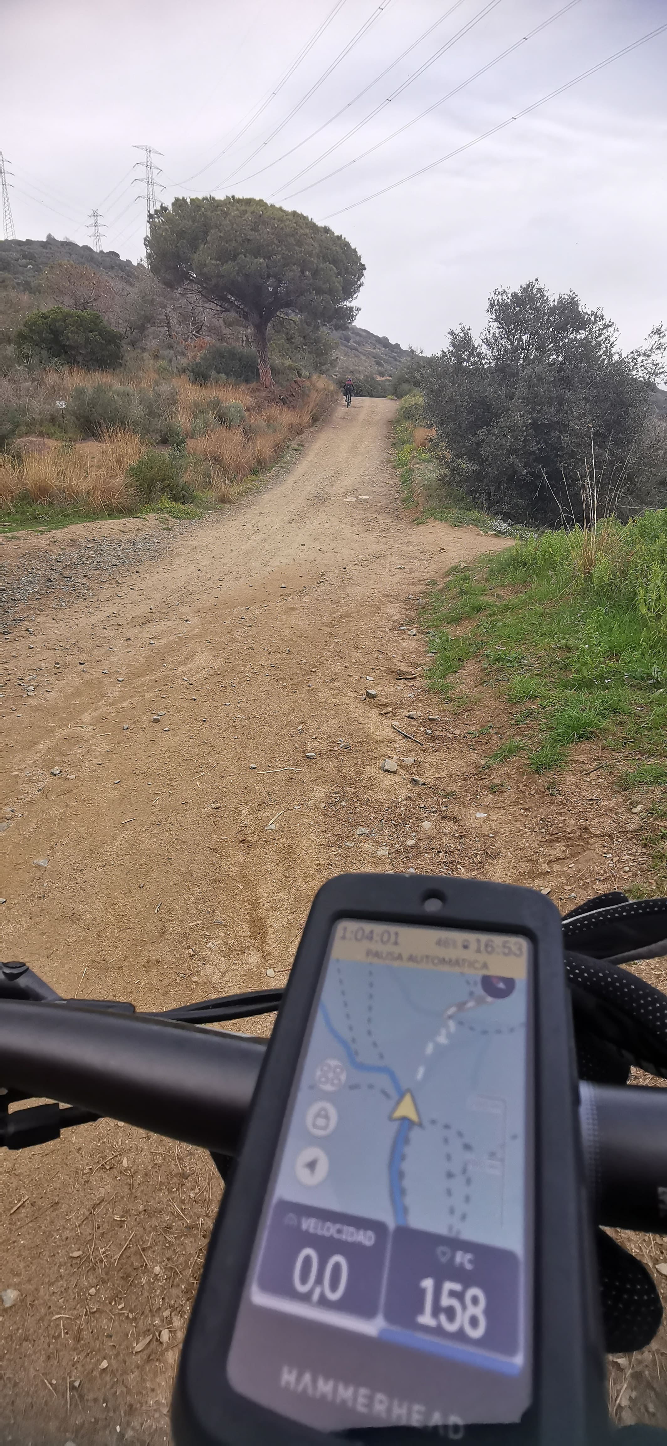
-
@productteam
Brief follow-up to your comment “We do not route on those paths for navigation”.
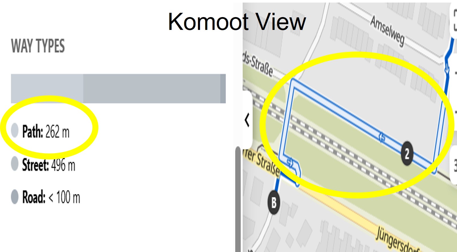
Yes, if I plan my routes in the Hammerhead Dashboard, I can't use the footpaths. On the other hand, all portals (e.g. RideWithGPS; Komoot; Bosch eBike Connect, Bikerouter, etc.) that I use for route planning allow routing via footpaths.
Using the detailed surface info (e.g. Komoot-View), you can see whether paths are used during planning and I can decide whether I need/want to bypass them if necessary.
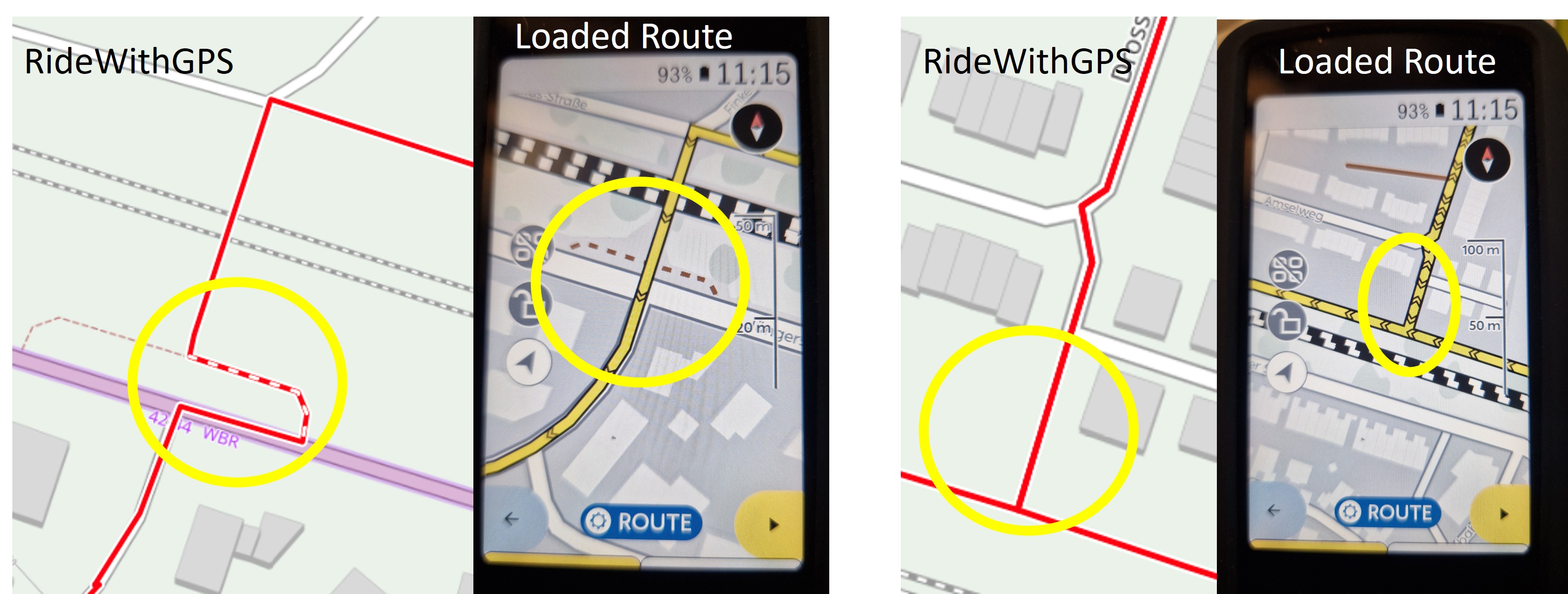
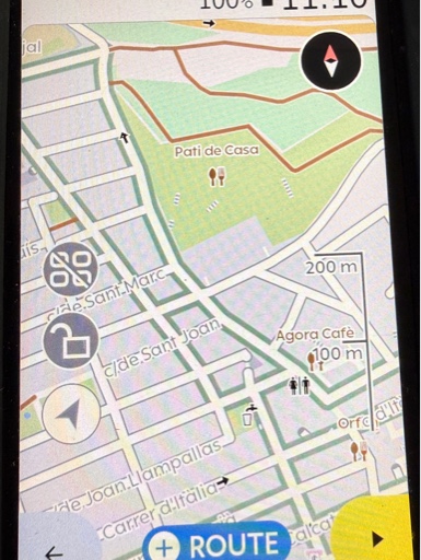
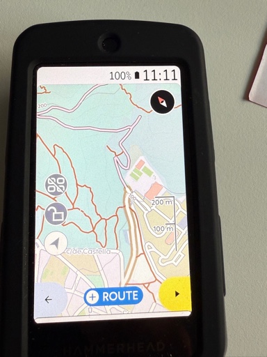
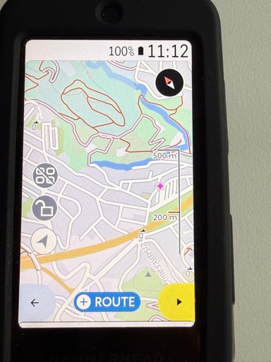
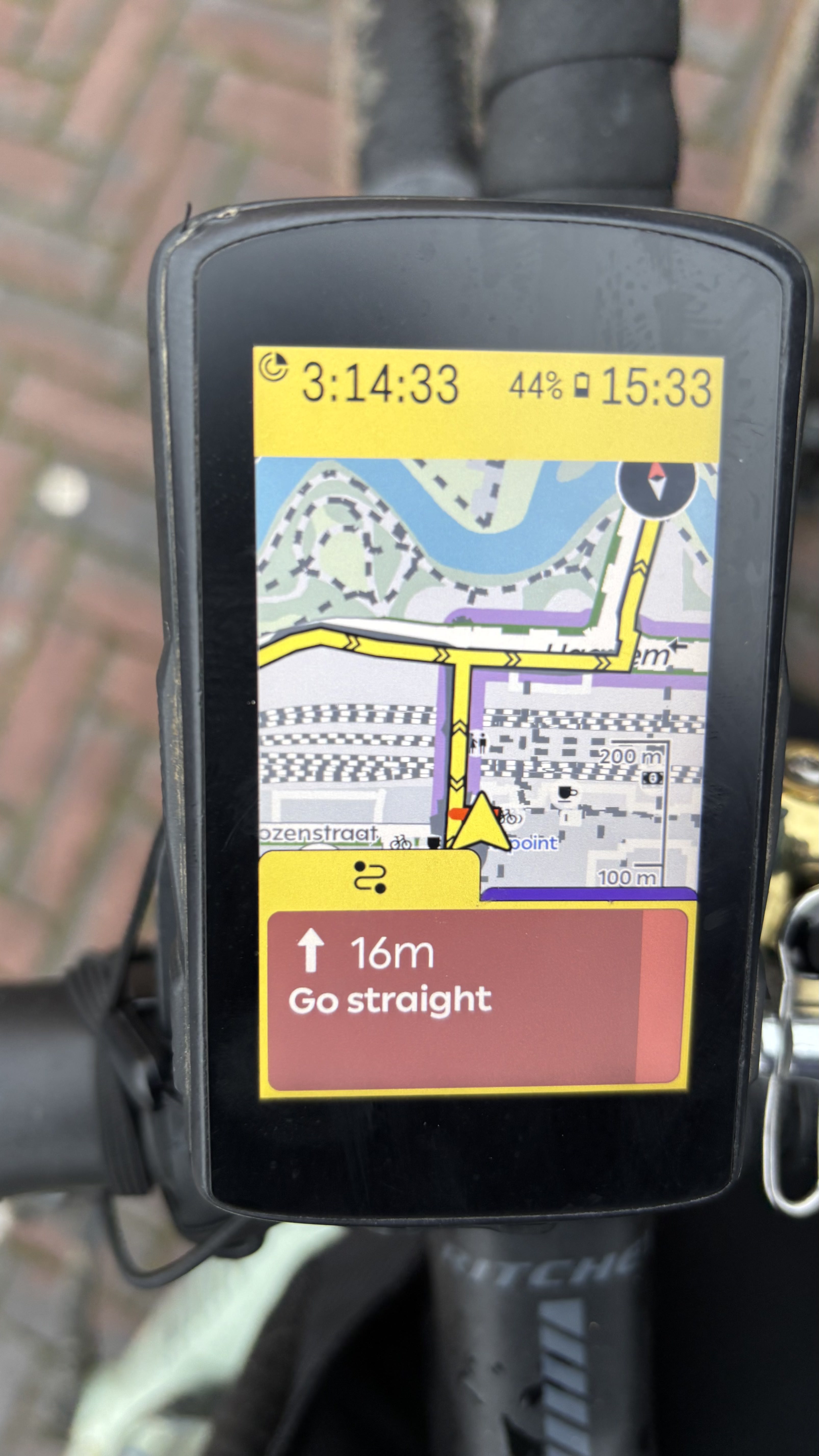
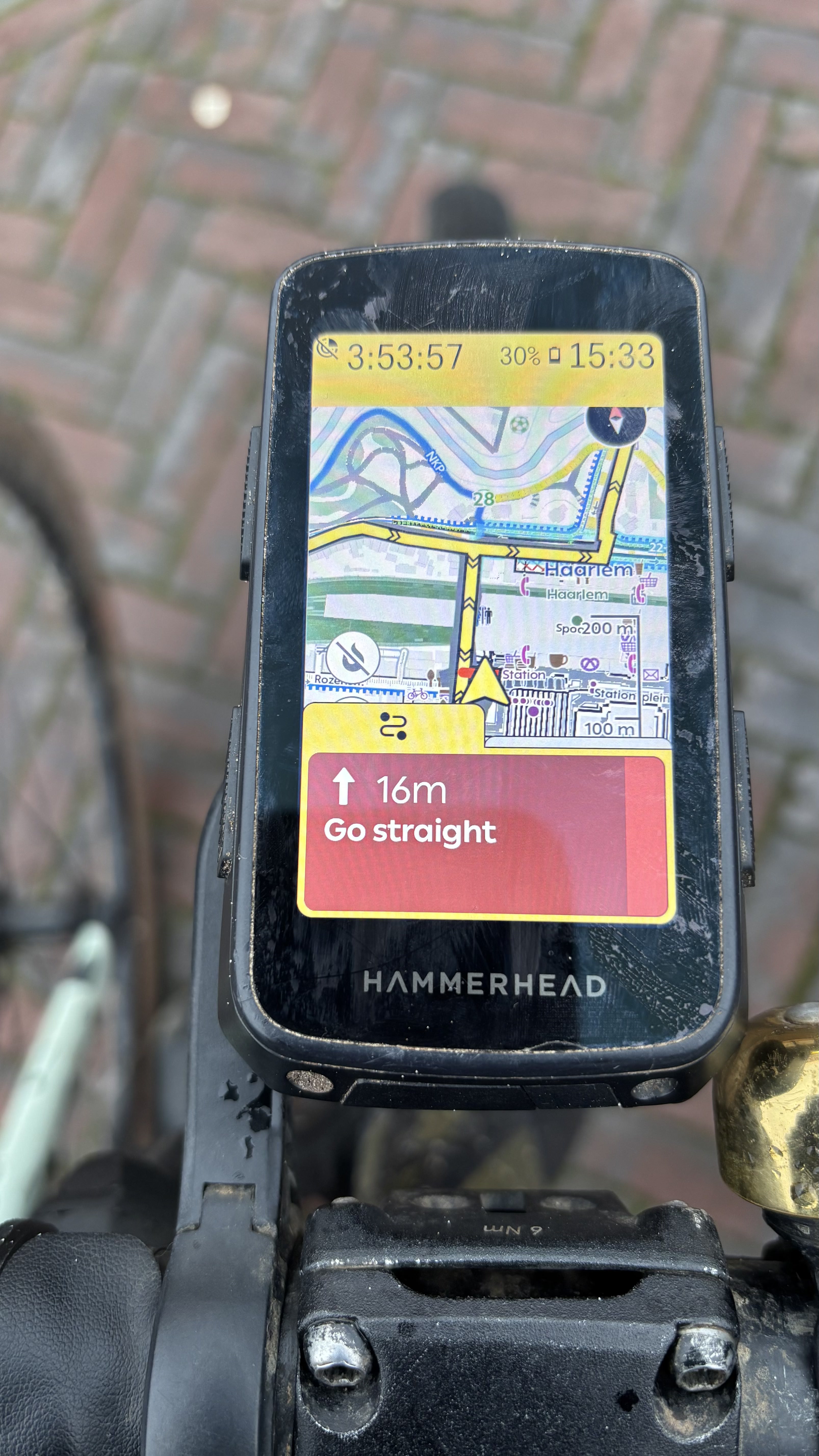
After loading these routes onto the Karoo for TBT navigation, the footpaths are in most cases correctly displayed/used on the route, except for minimal restrictions (see the two left-hand pictures).
From my personal point of view, this restriction makes no sense, especially since there are a lot of international/regional differences or regulations as to when and by whom such paths may be used. In the event that I should come across a path during navigation that I am not supposed to use, there is always the first-class rerouting in the Karoo 😉
-

@Product Team:
The reason things like this exists, because the default theme is pretty much unusable for me as a mountain biker. For example simple foot paths in your theme look the same as full forest roads you can ride cars on. But I only want to have a look on the Karoo Map and be able to understand what road this will be.The Komoot Map Style is imho as good as you can get for mountain biking. Thats why I still use this style, if you need some inspiration have a look at it: https://support.hammerhead.io/hc/en-us/community/posts/1500000096241-Map-Style-Improvements
It would be super if you would finally give us some more styles to choose from. I bought my Karroo 2 like four years ago and I got out of mountainbiking because of a injury like three years ago. Trying to get back into it, and the feature is still missing. At least the trick of swapping out the xml still does work, if you don't do anything, at least don't remove this feature.Sorry OP for hijacking this thread about your awesome work. Saw that the Product Team posted here, so I wanted to get my two cents in.


 Another xml with openorg maps. All regional local and national mtb and race routes, contour lines and lots of poi on it. Detailled surface info. waters and woods not shown very nice…. Shown is Karoo 2 with regular maps and xml and my Karoo with open org setup.


Please sign in to leave a comment.
Comments
30 comments