Standard POI on the map

Please add e.g. grocery stores, bars, hostels, etc. on the map as standard points without having to define them in my route. Sometimes when I'm far from home, I just want to eat something. Why do I have to take out my phone to find a store? It would be nice if such points were shown as an additional layer on the map, which can be turned on or off. Of course, the font size should be such that you can read what's there, because now the letters are so small that you can't see anything.
-

Hi Gregory,
Thanks for sharing your feedback with us, and I've shared your suggestions with our team.
Our Karoo uses Open Street Maps (OSM) for navigation, and the Karoo displays data about nearby places as shown on the OSM. Since OSM data can be updated by the user community, some areas are detailed while others might not be. You can request edits directly on the OSM website, and any updates will reflect on the Karoo base map. We ensure to roll out map updates biannually, so you can expect ongoing improvements!
In the meantime, you can drop the pin and use the POI feature to add some POIs for food and drink breaks/places; you will get the alerts on TBT for the same. You can also share the locations via the companion app. -
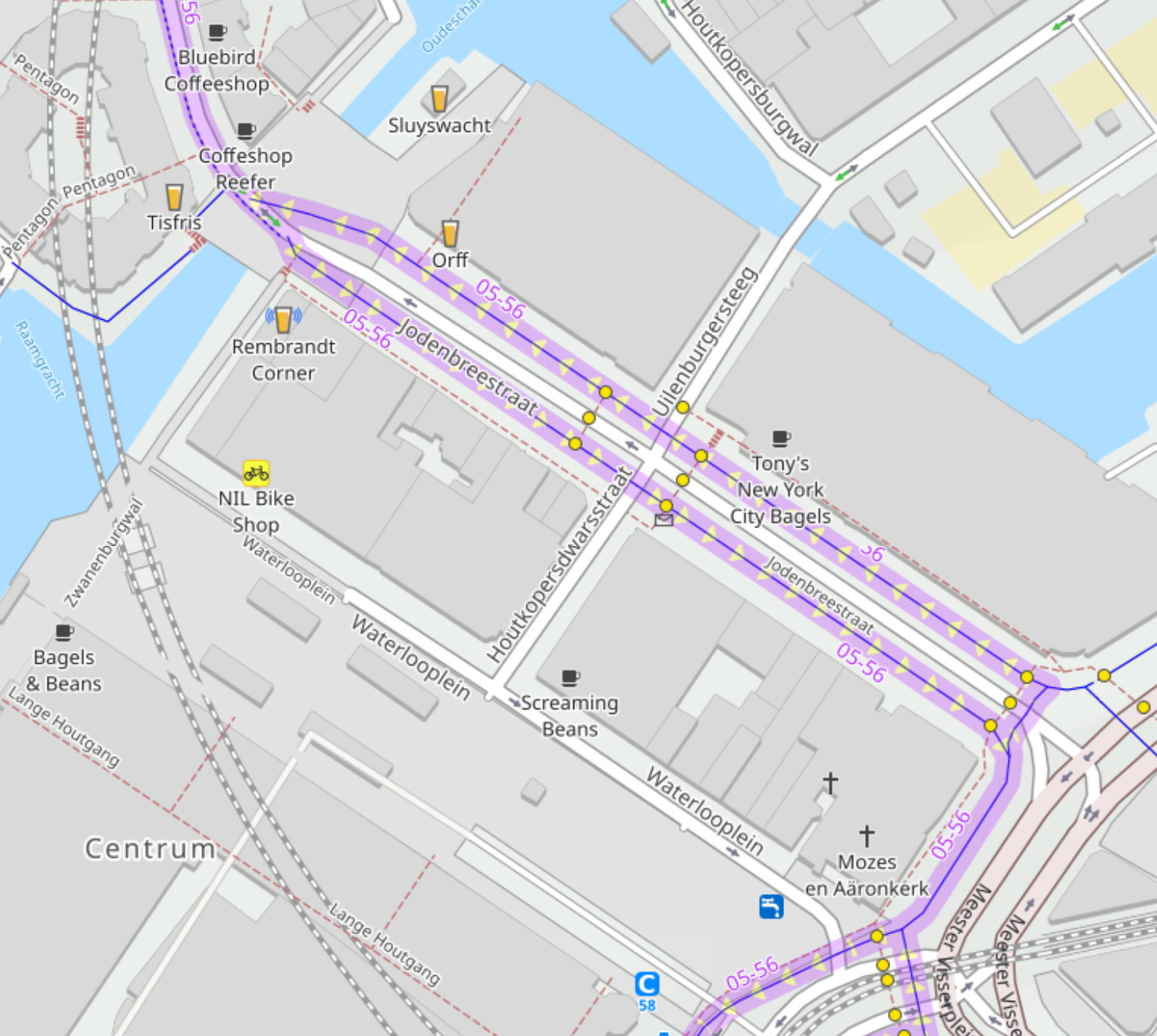
Still no changes in the route planner. These maps are poor and non-interactive. As I said, I dream of well-known, public POIs being visible (as a map layer) and clickable, for example, to check if it's worth going there or if it's already closed. Such functionality in the dashboard would be really cool. In the device itself, it would be enough to have the option to turn on the public POI layer. As usual, I'll repeat what I always say, if Garmin has it in devices, why doesn't it have Karoo? Below are a few screens to compare with the HH dashboard and with mapy.cz (currently mapy.com).
HH Dashboard all what you see it is only images. No address, no info, not clicable.
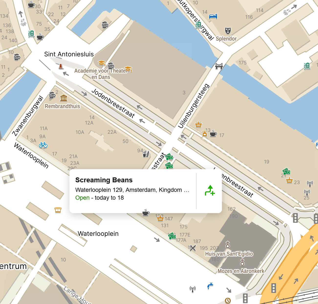
mapy.cz you can stay coursor over icon and you see additiona info and possibility to add to the route
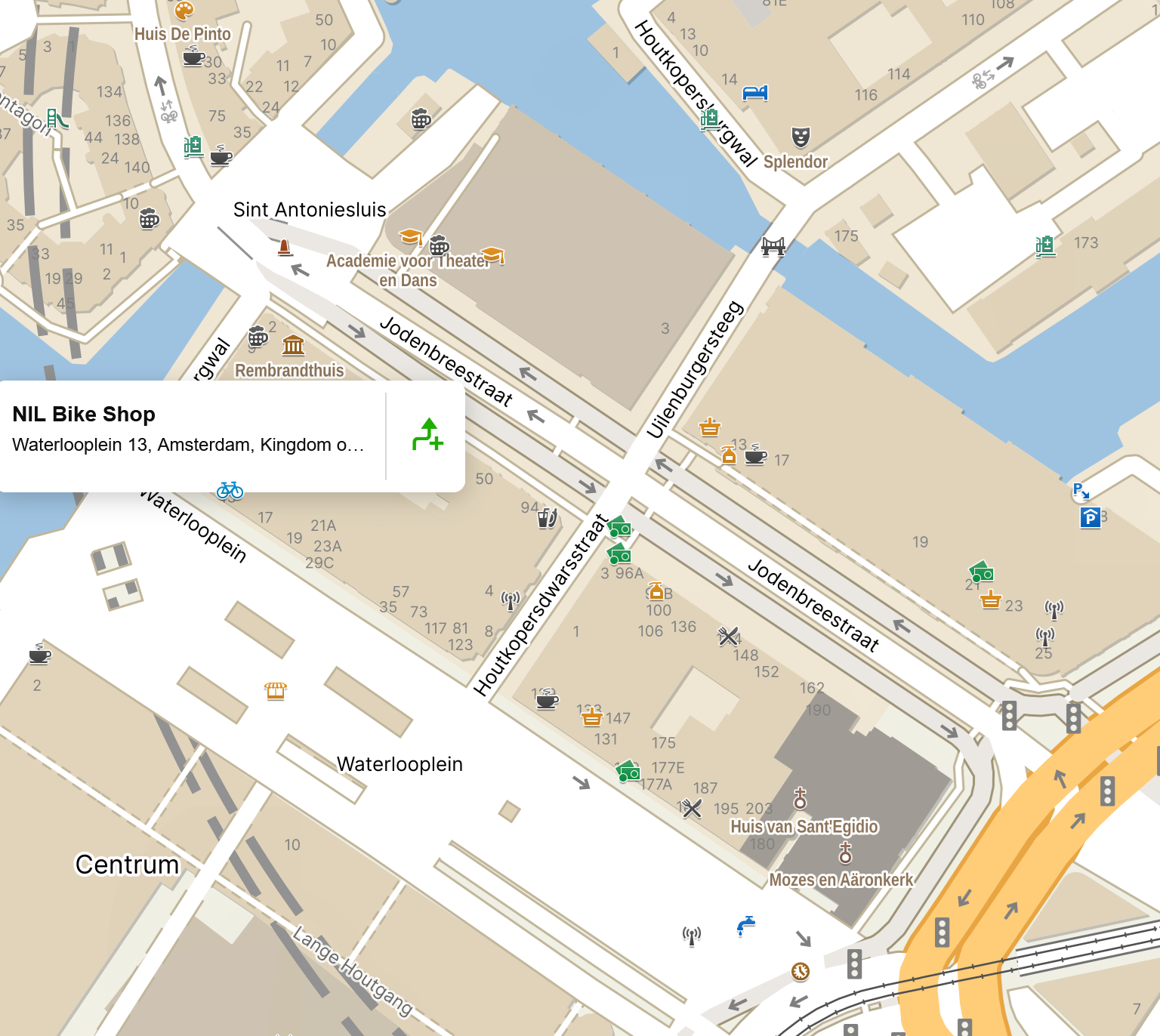
Some places have info about opening hours.
Bike services, shops, coffee bar, atm, etc.
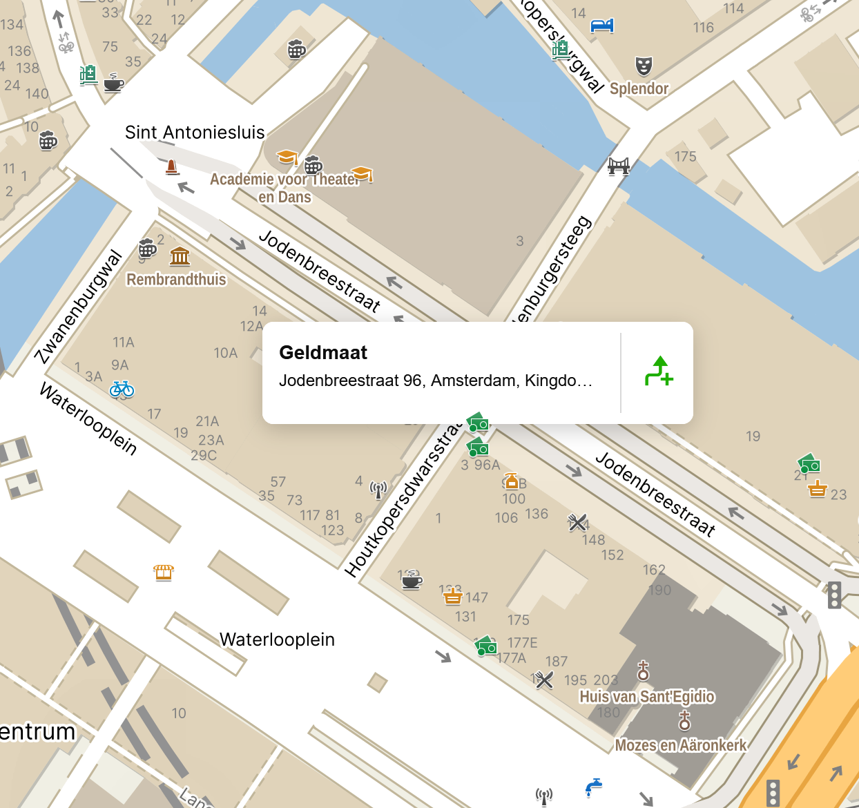
You can on/off additional layers eg turistic, photos (added by users).

All of this makes maps like this very useful for planning routes.
Please consider expanding the route planner, as the current one is very poor. Don't forget about the POI layer on your device.
-

In case it helps, I'm loving this: https://cycle.travel
Uses traffic data to try to avoid busy roads. Of course, one must download the GPX, then upload to HH, then sync the Karoo.
Please sign in to leave a comment.
Comments
3 comments