Upcoming elevation without selecting route

Answered

Comments

10 comments

  • Avatar
    Chris White

    That sounds incredibly complicated and unreliable and not worth spending time on IMO. In addition, if the base map doesn't include elevation data, which I expect it doesn't, then the device would not even know that information.

    0
    Comment actions Permalink
  • Avatar
    Piergiorgio Ghezzo

    But it's possible to show the past elevation, to have an idea about what you did.

    0
    Comment actions Permalink
  • Avatar
    Pieter Olivier

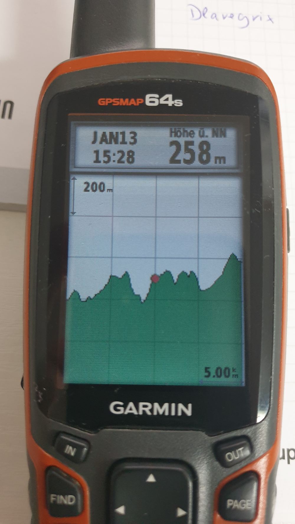
    @Chris White, you’ve clearly never climb a hill wile seeing the upcoming elevation profile. It’s extremely, extremely useful! The only problem is, you can only see the upcoming elevation if you selected a route. Every bike computer (or the decent ones) have maps on it, personally I can’t see why it can’t show the elevation 100m ahead on the road you’re traveling on. Shouldn’t be that complicated if you use one or two basic assumptions to predict the direction you’re expected to head to based on the direction you’re going...

    1
    Comment actions Permalink
  • Avatar
    Pieter Olivier

    To be clear. I’m talking about the elevation profile.

    0
    Comment actions Permalink
  • Avatar
    Hari Krishnan

    Hi Pieter,

    We completely understand your point. Currently, the upcoming elevation won't be available without a Route. I am considering your message as feedback and forwarding this to the software team. They will be happy to discuss this.

    1
    Comment actions Permalink
  • Avatar
    Gerald Ruis

    That would be really great. My Garmin can do that too (2 pictures attached).

    1
    Comment actions Permalink
  • Avatar
    Chris White

    Do the base maps on the device even include elevation data? Often free maps do not, only the paid versions do.

    0
    Comment actions Permalink
  • Avatar
    brian chavez

    si es muy necesario la elevacion sin cargar ruta, ojala y le den la importancia para los amantes del mtb

    0
    Comment actions Permalink
  • Avatar
    Adrian Borrallo

    I also agree that elevation profile should be available without having to select a route. I mean, if the GPS knows where the rider is located, it should not be very difficult. This is a very important feature for a rider that is exploring an area without having a predefined route. I used my K2 for the first time on Sunday and was quite disappointed that the historical elevation graph was occupying more than half of the screen without actually working...

    1
    Comment actions Permalink
  • Avatar
    Hari Krishnan

    @Andrian: This is exactly where we are heading towards and we have already kickstarted this project. You will see incremental implementations with regards to upcoming Elevation in the coming releases.

    3
    Comment actions Permalink

Please sign in to leave a comment.