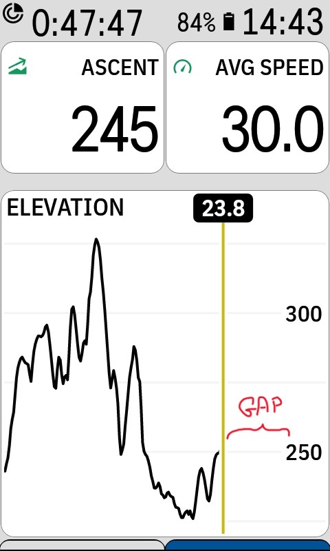
Inefficient usage of Elevation graph area
Tho this is not a huge deal breaker, it's still mind boggling, why the graph is being plotted with such a big gap between the current elevation (yellow vertical line) and the right vertical axis.
I know that realistically it's maybe about 0.5 cm gap on the screen but still I'd like to understand if this is on purpose or what.

Please sign in to leave a comment.
Comments
1 comment